E. Bowen The General Magazine of Arts and Sciences/The Natural History of England 1760
This map first appeared in the March 1760 number of Benjamin Martin's General Magazine of Arts and Sciences, a monthly partwork which between 1755 and 1762 included a series of county maps. The magazine's format was novel, each issue covering 5 (later 6) subject areas. The intention was that all those parts relating to any one subject could later be rebound into subject volumes, for which individual title pages would be issued. In 1763 title pages for a two volume set were issued for those parts relating to natural history. Subscribers could then, if so desired, rebind their original partworks, and new purchasers could purchase the completed work under the title, The Natural History of England. There were no later re-issues and the maps are today not common. Modern hand colour. Supplied ready-mounted.
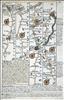
Britannia Depicta was one of 3 pocket-sized reductions of Ogilby's road book that appeared within an 18 month timeframe between 1719 and 1720. It was more innovative than the others in including much additional topographical and historical information (researched by John Owen) on the maps. The work was a commercial success and ran to many later editions, this example being from the first edition of 1720.
Britannia Depicta was one of 3 pocket-sized reductions of Ogilby's road book that appeared within an 18 month timeframe between 1719 and 1720. It was more innovative than the others in including much additional topographical and historical information (researched by John Owen) on the maps. The work was a commercial success and ran to many later editions.
The Royal English Atlas was probably an attempt to repeat the commercial success of The Large English Atlas, with a somewhat smaller format. The maps were again engraved by Kitchin and Bowen, and the partners in the enterprise were based around the consortium that had finally brought out The Large English Atlas in 1760. This time, however, they misjudged the market, and although there were some later re-issues of the atlas, the modern rarity of the maps suggests it was not very successful. This example is from the first edition, and is most attractively coloured.
E. Bowen The General Magazine of Arts and Sciences/The Natural History of England 1758
This map first appeared in the December 1758 number of Benjamin Martin's General Magazine of Arts and Sciences, a monthly partwork which between 1755 and 1762 included a series of county maps. The magazine's format was novel, each issue covering 5 (later 6) subject areas. The intention was that all those parts relating to any one subject could later be rebound into subject volumes, for which individual title pages would be issued. In 1763 title pages for a two volume set were issued for those parts relating to natural history. Subscribers could then, if so desired, rebind their original partworks, and new purchasers could purchase the completed work under the title, The Natural History of England. There were no later re-issues and the maps are today not common. Minor restoration to the lower right-hand white margin. Supplied with the original ten text pages describing the county.
E. Bowen Large English Atlas 1760 (1751)
The idea for a new county atlas, with a large format bigger than any predecessor, was initiated in 1749 by John Hinton. For a variety of reasons, however, progress was slow. Maps were offered for individual sale as the printing plates were completed, but the series was not finished until 1760 when the atlas was finally published. All but a few of the maps were drawn and engraved by Emanuel Bowen and Thomas Kitchin. The atlas proved to be a commercial success, and a number of later editions were issued up to 1787. The Cambridgeshire map, engraved by Bowen, was one of the first published in 1751. The presence of a centrefold, and the publishers' names on the imprint (John Tinney, Thomas Bowles, John Bowles & Son, and Robert Sayer) date this example to the first atlas edition of 1760. Original outline colour.
Britannia Depicta was one of 3 pocket-sized reductions of Ogilby's road book that appeared within an 18 month timeframe between 1719 and 1720. It was more innovative than the others in including much additional topographical and historical information (researched by John Owen) on the maps. The work was a commercial success and ran to many later editions.
Britannia Depicta was one of 3 pocket-sized reductions of Ogilby's road book that appeared within an 18 month timeframe between 1719 and 1720. It was more innovative than the others in including much additional topographical and historical information (researched by John Owen) on the maps. The work was a commercial success and ran to many later editions.
Coloured. Some repaired marginal tears including 2 impinging c 3cm within the bottom right border of the map. Otherwise a good and early example. This new series of maps was commenced in 1749, with maps sold singly until the last counties were completed and the full series issued in 1760 as the Large English Atlas. Derbyshire was first issued in 1758. J.Tinney's name on the imprint dates this copy to the first edition of the atlas in 1760 or earlier.
The General Magazine of Arts and Sciences/The Natural History of England. This map first appeared in the August 1755 number of Benjamin Martin's General Magazine of Arts and Sciences, a monthly partwork which between 1755 and 1762 included a series of county maps. The magazine's format was novel, each issue covering 5 (later 6) subject areas. The intention was that all those parts relating to any one subject could later be rebound into subject volumes, for which individual title pages would be issued. In 1763 title pages for a two volume set were issued for those parts relating to natural history. Subscribers could then, if so desired, rebind their original partworks, and new purchasers could purchase the completed work under the title, The Natural History of England. There were no later re-issues and the maps are today not common.

This map first appeared in 1767 in the Atlas Anglicanus, published by Thomas Kitchin with maps engraved by Emanuel and Thomas Bowen. The maps copied the Large English Atlas in style, with rococo cartouches, and topographical notes surrounding the maps. The maps for the Atlas Anglicanus were first issued in monthly partworks between 1767 and 1768 before the complete atlas followed in 1768. The first state Doset map bears the signature of Emanuel Bowen alone, who was involved only in the early maps in the set before his death in early 1767. There was a second edition of the atlas in c1777, before the plates passed to Carington Bowles and were updated and re-issued as Bowles' New Medium English Atlas in 1785. On Bowles' death the plates passed to his business successors, trading as Bowles and Carver, who re-issued the atlas sometime after 1793 with their own imprint as proprietors on individual maps. The Atlas Anglicanus was not a commercial success and maps from it are not commonly found. This example is dated 1785, and is thus from the map's first issue by Bowles. Original colour. A short, repaired tear to the lower centrefold, just entering the border, but without loss.
Britannia Depicta was one of 3 pocket-sized reductions of Ogilby's road book that appeared within an 18 month time frame between 1719 and 1720. It was more innovative than the others in including much additional topographical and historical information (researched by John Owen) on the maps. The work was a commercial success and ran to many later editions, this example being from the first edition of 1720.
E. Bowen Large English Atlas c1764-67 (1749)
The idea for a new county atlas, with a large format bigger than any predecessor, was initiated in 1749 by John Hinton. For a variety of reasons, however, progress was slow. Maps were offered for individual sale as the printing plates were completed, but the series was not finished until 1760 when the atlas was finally published. All but a few of the maps were drawn and engraved by Emanuel Bowen and Thomas Kitchin. The atlas proved to be a commercial success, and a number of later editions were issued up to 1787. The Essex map, engraved by Bowen, was one of the first published 1749. The publishers imprint on this example (John Bowles, Carington Bowles and Robert Sayer) dates it to between c 1764 and c1787. Light overall toning. The margins are narrow, but sufficient for mounting and framing.
Britannia Depicta was one of 3 pocket-sized reductions of Ogilby's road book that appeared within an 18 month timeframe between 1719 and 1720. It was more innovative than the others in including much additional topographical and historical information (researched by John Owen) on the maps. The work was a commercial success and ran to many later editions, and this example is probably from one of the latter. Supplied mounted and ready for framing.
Britannia Depicta was one of 3 pocket-sized reductions of Ogilby's road book that appeared within an 18 month time-frame between 1719 and 1720. It was more innovative than the others in including much additional topographical and historical information (researched by John Owen). It also included a set of English and Welsh county maps as well as the road maps, all of which were engraved by Emanuel Bowen.The work was a commercial success and ran to many later editions.
Britannia Depicta was one of 3 pocket-sized reductions of Ogilby's road book that appeared within an 18 month timeframe between 1719 and 1720. It was more innovative than the others in including much additional topographical and historical information (researched by John Owen) on the maps. The work was a commercial success and ran to many later editions.
E. Bowen Large English Atlas 1756-60 (1756)
Map includes Rutland. Original outline colour. Some old folds with a pinhole where they meet within the upper right text block. Some repaired marginal tears not affecting the printed area. This new series of maps was commenced in 1749, with maps sold singly until the last counties were completed and the full series issued in 1760 as the Large English Atlas. Leicestershire-Rutland was first issued in 1756. J.Tinney's name on the imprint dates this copy to the first edition of the atlas in 1760 or earlier.
E. Bowen Large English Atlas 1767-80 (1751)
This new series of maps was commenced in 1749, with maps sold singly until the last counties were completed and the full series issued in 1760 as the Large English Atlas. Lincolnshire was first issued in 1751. The imprint of Robert Sayer and Carington Bowles dates this example to the editions of c1767-1780. Original outline colour.
Britannia Depicta was one of 3 pocket-sized reductions of Ogilby's road book that appeared within an 18 month timeframe between 1719 and 1720. It was more innovative than the others in including much additional topographical and historical information (researched by John Owen) on the maps. The work was a commercial success and ran to many later editions.
Britannia Depicta was one of 3 pocket-sized reductions of Ogilby's road book that appeared within an 18 month timeframe between 1719 and 1720. It was more innovative than the others in including much additional topographical and historical information (researched by John Owen) on the maps. The work was a commercial success and ran to many later editions, this example being from the first edition of 1720.
Britannia Depicta was one of 3 pocket-sized reductions of Ogilby's road book that appeared within an 18 month timeframe between 1719 and 1720. It was more innovative than the others in including much additional topographical and historical information (researched by John Owen) on the maps. The work was a commercial success and ran to many later editions, this example being from the first edition of 1720.
E. Bowen Royal English Atlas 1777 (c1764)
The Royal English Atlas, first published around 1764, was probably an attempt to repeat the commercial success of The Large English Atlas, with a somewhat smaller format. The maps were again engraved by Kitchin and Bowen, and the partners in the enterprise were based around the consortium that had finally brought out The Large English Atlas in 1760. This time, however, they misjudged the market, and although there were some later re-issues of the atlas, the modern rarity of the maps suggests it was not very successful. This example, dated 1777, bears the publishers' imprint of R. Sayer,J. Bennett, J. Bowles and C. Bowles. Slight browning to the outer margins, and centrefold repairs without loss. Original outline colour.
Britannia Depicta was one of 3 pocket-sized reductions of Ogilby's road book that appeared within an 18 month timeframe between 1719 and 1720. It was more innovative than the others in including much additional topographical and historical information (researched by John Owen) on the maps. The work was a commercial success and ran to many later editions, this example being from the first edition of 1720.
Britannia Depicta was one of 3 pocket-sized reductions of Ogilby's road book that appeared within an 18 month timeframe between 1719 and 1720. It was more innovative than the others in including much additional topographical and historical information (researched by John Owen) on the maps. The work was a commercial success and ran to many later editions, this example being from the first edition of 1720.
Britannia Depicta was one of 3 pocket-sized reductions of Ogilby's road book that appeared within an 18 month timeframe between 1719 and 1720. It was more innovative than the others in including much additional topographical and historical information (researched by John Owen) on the maps. The work was a commercial success and ran to many later editions the last in 1764. Modern colour.
E. Bowen Large English Atlas 1756-60 (1756)
Map includes Leicestershire. Original outline colour. Some old folds with a pinhole where they meet within the upper right text block. Some repaired marginal tears not affecting the printed area.This new series of maps was commenced in 1749, with maps sold singly until the last counties were completed and the full series issued in 1760 as the Large English Atlas. Leicestershire-Rutland was first issued in 1756. J.Tinney's name on the imprint dates this copy to the first edition of the atlas in 1760 or earlier.


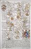
In 1720 Thomas Bowles and Emanuel Bowen published a new reduced version of John Ogilby's strip maps. Britannia Depicta came hot on the heels of the two reduced editions issued the previous year by Thomas Gardner and John Senex, but was much more innovative. Where Gardner and Senex had closely followed the strip layout and design of Ogilby, the new work further reduced the size of the volume, by including only 3 or 4 strips per page, and by printing on both sides of the page, but also added a considerable amount of additional detail by way of historical and topographical notes and heraldry. This additional information turned the work into much more than just a road book - it was virtually a guide book. This added detail was researched and provided by John Owen, who passed it to Bowen to incorporate into the layout and engraving of the pages. The work also included a set of English and Welsh county maps. Britannia Depicta became a great commercial success, and was re-issued a number of times up to 1764, with occasional amendments and additions. This example has a road map to the verso showing the road from York to Pickering via Malton..
Britannia Depicta was one of 3 pocket-sized reductions of Ogilby's road book that appeared within an 18 month timeframe between 1719 and 1720. It was more innovative than the others in including much additional topographical and historical information (researched by John Owen) on the maps. The work was a commercial success and ran to many later editions.Supplied mounted.
North & East Ridings. Britannia Depicta was one of 3 pocket-sized reductions of Ogilby's road book that appeared within an 18 month time-frame between 1719 and 1720. It was more innovative than the others in including much additional topographical and historical information (researched by John Owen). It also included a set of English and Welsh county maps as well as the road maps, all of which were engraved by Emanuel Bowen.The work was a commercial success and ran to many later editions.
E. Bowen Royal English Atlas c1764-1774 (1764)
Whole County. The Royal English Atlas was probably an attempt to repeat the commercial success of The Large English Atlas, with a somewhat smaller format. The maps were again engraved by Kitchin and Bowen, and the partners in the enterprise were based around the consortium that had finally brought out The Large English Atlas in 1760. This time, however, they misjudged the market, and although there were some later re-issues of the atlas, the modern rarity of the maps suggests it was not very successful. This example is from the first edition, and is in original outline colour. Apart from being offered in atlas format the maps were also sold singly, as with this example, which is dissected, linen-backed and folds into its original slip case. The publishers' imprint dates this map to c1764-74. Light overall toning.
E. Bowen Royal English Atlas 1777 (c1764)
North Riding. The Royal English Atlas, first published around 1764, was probably an attempt to repeat the commercial success of The Large English Atlas, with a somewhat smaller format. The maps were again engraved by Kitchin and Bowen, and the partners in the enterprise were based around the consortium that had finally brought out The Large English Atlas in 1760. This time, however, they misjudged the market, and although there were some later re-issues of the atlas, the modern rarity of the maps suggests it was not very successful. This example, dated 1777, bears the publishers' imprint of R. Sayer,J. Bennett, J. Bowles and C. Bowles.Original outline colour. Slight horizontal crease.
E. Bowen The General Magazine of Arts and Sciences/The Natural History of England 1756
This map first appeared in the January 1756 number of Benjamin Martin's General Magazine of Arts and Sciences, a monthly partwork which between 1755 and 1762 included a series of county maps. The magazine's format was novel, each issue covering 5 (later 6) subject areas. The intention was that all those parts relating to any one subject could later be rebound into subject volumes, for which individual title pages would be issued. In 1763 title pages for a two volume set were issued for those parts relating to natural history. Subscribers could then, if so desired, rebind their original partworks, and new purchasers could purchase the completed work under the title, The Natural History of England. There were no later re-issues and the maps are today not common. A repaired tear entering the right-hand margin by c3cms. without loss.
Original colour. Dissected and linen-backed, folding into its original slip case. Publication of the maps that eventually made up the Large English Atlas began in 1749. Lancashire was published in c1752, with the full Atlas being completed in 1760. Maps were also sold singly, either as full sheets or sometimes dissected and linen-backed as this example. The imprint of Carington Bowles and Robert Sayer dates this example to c 1767-79.
E. Bowen Large English Atlas 1750-60 (1750)
A detailed and most interesting map. This new series of maps was begun in 1749, with maps being sold singly until the last counties were completed and the full series issued in 1760 as the Large English Atlas. Surrey was first issued in 1750. The publishers' names on the imprint are John Tinney, Robert Sayer, John Bowles and Thomas Bowles, which dates this example to c1755 - 1760. The remains of the guard on the verso suggests the first atlas edition of 1760 as the most likely date. Recently coloured - a new image can be sent on request. A repair to bottom centrefold and a few small nibble to the outer margins. Slight age toning to the paper.
First published in 1720 with maps drawn and engraved by Emanuel Bowen, Britannia Depicta was a considerable commercial success and ran to several editions, the last issued around 1764.
Britannia Depicta was one of 3 pocket-sized reductions of Ogilby's road book that appeared within an 18 month timeframe between 1719 and 1720. It was more innovative than the others in including much additional topographical and historical information (researched by John Owen) on the maps. The work was a commercial success and ran to many later editions up to c1764. Supplied mounted and ready to frame.
E. Bowen The General Magazine of Arts and Sciences/The Natural History of England 1759
This map first appeared in the January 1759 number of Benjamin Martin's General Magazine of Arts and Sciences, a monthly partwork which between 1755 and 1762 included a series of county maps. The magazine's format was novel, each issue covering 5 (later 6) subject areas. The intention was that all those parts relating to any one subject could later be rebound into subject volumes, for which individual title pages would be issued. In 1763 title pages for a two volume set were issued for those parts relating to natural history. Subscribers could then, if so desired, rebind their original partworks, and new purchasers could purchase the completed work under the title, The Natural History of England. There were no later re-issues and the maps are today not common.
Britannia Depicta was one of 3 pocket-sized reductions of Ogilby's road book that appeared within an 18 month time-frame between 1719 and 1720. It was more innovative than the others in including much additional topographical and historical information (researched by John Owen). It also included a set of English and Welsh county maps as well as the road maps, all of which were engraved by Emanuel Bowen.The work was a commercial success and ran to many later editions. This is the second state of the map.
E. Bowen Large English Atlas 1768-79 (1749)
This new series of maps was commenced in 1749, with maps sold singly until the last counties were completed and the full series issued in 1760 as the Large English Atlas. Norfolk was first issued in 1749. The joint imprint of Carrington Bowles and Robert Sayer dates this example to c1768-1779. Repair to lower centrefold split and 2 small holes, but otherwise a nice copy in original outline colour.
Britannia Depicta was one of 3 pocket-sized reductions of Ogilby's road book that appeared within an 18 month timeframe between 1719 and 1720. It was more innovative than the others in including much additional topographical and historical information (researched by John Owen) on the maps. The work was a commercial success and ran to many later editions. Modern colour. Supplied mounted and ready to frame.

The success of the Large English Atlas from 1760 encouraged Emanuel Bowen and Thomas Kitchin to produce reduced-scale versions to cover the markets for medium and small-size atlases. The Royal English Atlas was published in c 1764 to target the medium-size market, and the Atlas Anglicanus followed for the small-scale market. Both copied the Large English Atlas in style, with rococo cartouches, and topographical notes surrounding the maps. The maps for the Atlas Anglicanus were first issued in monthly partworks between 1767 and 1768 before the complete atlas followed in 1768. Emanuel Bowen died in 1767, and his son Thomas took over the engraving of the remaining maps. Both Bowens are jointly cited as cartographers of the Middlesex map. Kitchin acted as publisher for the enterprise. There was a second edition of the atlas in c1777, before the plates passed to Carington Bowles and were updated and re-issued as Bowles' New Medium English Atlas in 1785. The Atlas Anglicanus was not a commercial success and maps from it are not commonly found.
E. Bowen Atlas Anglicanus 1768 or 1777 (1776)
This map first appeared in 1767 in the Atlas Anglicanus, published by Thomas Kitchin with maps engraved by Emanuel and Thomas Bowen. The maps copied the earlier Large English Atlas in style, with rococo cartouches, and topographical notes surrounding the maps. They were first issued in monthly partworks between 1767 and 1768 before the complete atlas followed in 1768. Emanuel Bowen was named as the sole author on the first state of the Bedfordshire map, as is the case on some 10 others, but after his death in 1767, his son Thomas completed the series, most other maps citing both father and son jointly. There was a second edition of the atlas in c1777, before the plates passed to Carington Bowles and were updated and re-issued as Bowles' New Medium English Atlas in 1785. On Bowles' death the plates passed to his business successors, trading as Bowles and Carver, who re-issued the atlas sometime after 1793 with their own imprint as proprietors on individual maps. The Atlas Anglicanus was not a commercial success and maps from it are not commonly found. This example is either from the atlas's first edition of 1768 or the second edition of 1777.
E. Bowen The General Magazine of Arts and Sciences/The Natural History of England 1757
This map first appeared in the January 1757 number of Benjamin Martin's General Magazine of Arts and Sciences, a monthly partwork which between 1755 and 1762 included a series of county maps. The magazine's format was novel, each issue covering 5 (later 6) subject areas. The intention was that all those parts relating to any one subject could later be rebound into subject volumes, for which individual title pages would be issued. In 1763 title pages for a two volume set were issued for those parts relating to natural history. Subscribers could then, if so desired, rebind their original partworks, and new purchasers could purchase the completed work under the title, The Natural History of England. There were no later re-issues and the maps are today not common.
E. Bowen Royal English Atlas 1777 (c1764)
The Royal English Atlas, first published around 1764, was probably an attempt to repeat the commercial success of The Large English Atlas, with a somewhat smaller format. The maps were again engraved by Kitchin and Bowen, and the partners in the enterprise were based around the consortium that had finally brought out The Large English Atlas in 1760. This time, however, they misjudged the market, and although there were some later re-issues of the atlas, the modern rarity of the maps suggests it was not very successful. This example, dated 1777, bears the publishers' imprint of R. Sayer,J. Bennett, J. Bowles and C. Bowles. Original outline colour. A few brown spots to the right-hand margin. Minor repairs to centrefold tears without loss. Slight browning to outer white margins. The verso has a hand-written poem celebrating the death of a famous poet (whose name is not given). This was probably written by the original owner. This does not show through to the recto.
E. Bowen General Magazine of Arts and Sciences 1762
This map first appeared in the May 1762 number of Benjamin Martin's General Magazine of Arts and Sciences, a monthly partwork which between 1755 and 1762 issued a set of county maps. In 1763 those parts relating to natural history were collected together into 2 volumes with the county maps and offered under the title The Natural History of England. There were no later re-issues and the maps are not common. Modern colour.
Britannia Depicta was one of 3 pocket-sized reductions of Ogilby's road book that appeared within an 18 month timeframe between 1719 and 1720. It was more innovative than the others in including much additional topographical and historical information (researched by John Owen) on the maps. The work was a commercial success and ran to many later editions the last in 1764. Modern colour.
E. Bowen The General Magazine of Arts and Sciences/The Natural History of England 1759
This map first appeared in the June 1759 number of Benjamin Martin's General Magazine of Arts and Sciences, a monthly partwork which between 1755 and 1762 included a series of county maps. The magazine's format was novel, each issue covering 5 (later 6) subject areas. The intention was that all those parts relating to any one subject could later be rebound into subject volumes, for which individual title pages would be issued. In 1763 title pages for a two volume set were issued for those parts relating to natural history. Subscribers could then, if so desired, rebind their original partworks, and new purchasers could purchase the completed work under the title, The Natural History of England. There were no later re-issues and the maps are today not common. Supplied ready-mounted.
Britannia Depicta was one of 3 pocket-sized reductions of Ogilby's road book that appeared within an 18 month timeframe between 1719 and 1720. It was more innovative than the others in including much additional topographical and historical information (researched by John Owen) on the maps. The work was a commercial success and ran to many later editions. This map covers the main offshore islands belonging to the English crown. Mounted and ready for framing.
E. Bowen Royal English Atlas 1778 (c1764)
The Royal English Atlas, first published around 1764, was probably an attempt to repeat the commercial success of The Large English Atlas, with a somewhat smaller format. The maps were again engraved by Kitchin and Bowen, and the partners in the enterprise were based around the consortium that had finally brought out The Large English Atlas in 1760. This time, however, they misjudged the market, and although there were some later re-issues of the atlas, the modern rarity of the maps suggests it was not very successful. This example, dated 1777, is from the second edition published in 1778, and is most attractively coloured.
E. Bowen The Large English Atlas 1764-79 (1756)
This new series of maps was commenced in 1749, with maps sold singly until the last counties were completed and the full series issued in 1760 as the Large English Atlas. Buckinghamshire was first issued in 1756. The imprint on this example bears the names of R.Sayer, J. Bowles and T. Bowles, dating it to an atlas edition of c1762-64. Original outline colour. The map has been laid on card, and is supplied in an attractive new gold frame.

This map first appeared in 1767 in the Atlas Anglicanus, published by Thomas Kitchin with maps engraved by Emanuel and Thomas Bowen. The maps copied the Large English Atlas in style, with rococo cartouches, and topographical notes surrounding the maps. The maps for the Atlas Anglicanus were first issued in monthly partworks between 1767 and 1768 before the complete atlas followed in 1768. Both Bowens are jointly cited as cartographers of the first state Shropshire map. There was a second edition of the atlas in c1777, before the plates passed to Carington Bowles and were updated and re-issued as Bowles' New Medium English Atlas in 1785. On Bowles' death the plates passed to his business successors, trading as Bowles and Carver, who re-issued the atlas sometime after 1793 with their own imprint as proprietors on individual maps. The Atlas Anglicanus was not a commercial success and maps from it are not commonly found. This example is from the atlas's final issue post 1793. Original colour.
The Royal English Atlas was probably an attempt to repeat the commercial success of The Large English Atlas, with a somewhat smaller format. The maps were again engraved by Kitchin and Bowen, and the partners in the enterprise were based around the consortium that had finally brought out The Large English Atlas in 1760. This time, however, they misjudged the market, and although there were some later re-issues of the atlas, the modern rarity of the maps suggests it was not very successful. This example is from the first edition, and is in original outline colour.
E. Bowen Bowles New Medium Atlas 1785 (1767)
This map first appeared in 1767 in the Atlas Anglicanus, published by Thomas Kitchin with maps engraved by Emanuel and Thomas Bowen. The maps copied the Large English Atlas in style, with rococo cartouches, and topographical notes surrounding the maps. The maps for the Atlas Anglicanus were first issued in monthly partworks between 1767 and 1768 before the complete atlas followed in 1768. Emanuel Bowen was named as the sole author on the first state of the Bedfordshire map, as is the case on some 10 others, but after his death in 1767, his son Thomas completed the series, most other maps citing both father and son jointly. There was a second edition of the atlas in c1777, before the plates passed to Carington Bowles and were updated and re-issued as Bowles' New Medium English Atlas in 1785. On Bowles' death the plates passed to his business successors, trading as Bowles and Carver, who re-issued the atlas sometime after 1793 with their own imprint as proprietors on individual maps. The Atlas Anglicanus was not a commercial success and maps from it are not commonly found. This example is from the atlas's 1785 issue by Bowles, for which individual map titles titles were changed, with Bowles name replacing that of Bowen. Original outline colour.
E. Bowen The General Magazine of Arts and Sciences/The Natural History of England 1758
This map first appeared in the August 1758 number of Benjamin Martin's General Magazine of Arts and Sciences, a monthly partwork which between 1755 and 1762 included a series of county maps. The magazine's format was novel, each issue covering 5 (later 6) subject areas. The intention was that all those parts relating to any one subject could later be rebound into subject volumes, for which individual title pages would be issued. In 1763 title pages for a two volume set were issued for those parts relating to natural history. Subscribers could then, if so desired, rebind their original partworks, and new purchasers could purchase the completed work under the title, The Natural History of England. There were no later re-issues and the maps are today not common.
E. Bowen General Magazine of Arts and Sciences 1762
This map first appeared in 1762 in Benjamin Martin's General Magazine of Arts and Sciences, a monthly partwork which between 1755 and 1762 issued a set of county maps. In 1763 those parts relating to natural history were collected together into 2 volumes with the county maps and offered under the title The Natural History of England. There were no later re-issues and the maps are not common. Modern colour.
E. Bowen The General Magazine of Arts and Sciences/The Natural History of England 1756
This map first appeared in the October 1756 number of Benjamin Martin's General Magazine of Arts and Sciences, a monthly partwork which between 1755 and 1762 included a series of county maps. The magazine's format was novel, each issue covering 5 (later 6) subject areas. The intention was that all those parts relating to any one subject could later be rebound into subject volumes, for which individual title pages would be issued. In 1763 title pages for a two volume set were issued for those parts relating to natural history. Subscribers could then, if so desired, rebind their original partworks, and new purchasers could purchase the completed work under the title, The Natural History of England. There were no later re-issues and the maps are today not common.

This map first appeared in 1767 in the Atlas Anglicanus, published by Thomas Kitchin with maps engraved by Emanuel and Thomas Bowen. The maps copied the Large English Atlas in style, with rococo cartouches, and topographical notes surrounding the maps. The maps for the Atlas Anglicanus were first issued in monthly partworks between 1767 and 1768 before the complete atlas followed in 1768. Emanuel Bowen's name alone appears on some maps, but his son Thomas is also credited as co-author on 33 maps. Emanuel died in early 1767.. There was a second edition of the atlas in c1777, before the plates passed to Carington Bowles and were updated and re-issued as Bowles' New Medium English Atlas in 1785. On Bowles' death the plates passed to his business successors, trading as Bowles and Carver, who re-issued the atlas sometime after 1793 with their own imprint as proprietors on individual maps. The Atlas Anglicanus was not a commercial success and maps from it are not commonly found. This example bears the signature of Bowles & Carver, and is the final state issued some time post 1793. Original wash colour. The verso shows signs of old paste, suggesting it was possibly once laid down, but the image is unaffected. Uncommon.
E. Bowen The General Magazine of Arts and Sciences/The Natural History of England 1756
This map first appeared in the April 1756 number of Benjamin Martin's General Magazine of Arts and Sciences, a monthly partwork which between 1755 and 1762 included a series of county maps. The magazine's format was novel, each issue covering 5 (later 6) subject areas. The intention was that all those parts relating to any one subject could later be rebound into subject volumes, for which individual title pages would be issued. In 1763 title pages for a two volume set were issued for those parts relating to natural history. Subscribers could then, if so desired, rebind their original partworks, and new purchasers could purchase the completed work under the title, The Natural History of England. There were no later re-issues and the maps are today not common.
E. Bowen The Large English Atlas c1767 (1756)
The idea for a new county atlas, with a large format bigger than any predecessor, was initiated in 1749 by John Hinton. For a variety of reasons, however, progress was slow. Maps were offered for individual sale as the printing plates were completed, but the series was not finished until 1760 when the atlas was finally published. All but a few of the maps were drawn and engraved by Emanuel Bowen and Thomas Kitchin. The atlas proved to be a commercial success, and a number of later editions were issued up to 1787. The Worcestershire map, engraved by Bowen, was first published in 1756. The presence of a centrefold, and the publishers' names on the imprint (Robert Sayer and Carington Bowles) date this example to an atlas edition of c1767. Original outline colour to the borders. Very minor repairs to a few short tears to the margins.

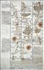
Pages 3/4 - High Wycombe, Tetsworth, Oxford, Islip, Morton-in-the-Marsh, Broadway. In 1720 Thomas Bowles and Emanuel Bowen published a new reduced version of John Ogilby's strip maps. Britannia Depicta came hot on the heels of the two reduced editions issued the previous year by Thomas Gardner and John Senex, but was much more innovative. Where Gardner and Senex had closely followed the strip layout and design of Ogilby, the new work further reduced the size of the volume, by including only 3 or 4 strips per page, and by printing on both sides of the page, but also added a considerable amount of additional detail by way of historical and topographical notes and heraldry. This additional information turned the work into much more than just a road book - it was virtually a guide book. This added detail was researched and provided by John Owen, who passed it to Bowen to incorporate into the layout and engraving of the pages. The work also included a set of English and Welsh county maps. Britannia Depicta became a great commercial success, and was re-issued a number of times up to 1764, with occasional amendments and additions.


Pages 5/6 - Pershore, Worcester, Leominster, Presteigne. In 1720 Thomas Bowles and Emanuel Bowen published a new reduced version of John Ogilby's strip maps. Britannia Depicta came hot on the heels of the two reduced editions issued the previous year by Thomas Gardner and John Senex, but was much more innovative. Where Gardner and Senex had closely followed the strip layout and design of Ogilby, the new work further reduced the size of the volume, by including only 3 or 4 strips per page, and by printing on both sides of the page, but also added a considerable amount of additional detail by way of historical and topographical notes and heraldry. This additional information turned the work into much more than just a road book - it was virtually a guide book. This added detail was researched and provided by John Owen, who passed it to Bowen to incorporate into the layout and engraving of the pages. The work also included a set of English and Welsh county maps. Britannia Depicta became a great commercial success, and was re-issued a number of times up to 1764, with occasional amendments and additions. Modern hand colour.


Pages 15/16 - Grantham, Newark, Tuxford, Doncaster. In 1720 Thomas Bowles and Emanuel Bowen published a new reduced version of John Ogilby's strip maps. Britannia Depicta came hot on the heels of the two reduced editions issued the previous year by Thomas Gardner and John Senex, but was much more innovative. Where Gardner and Senex had closely followed the strip layout and design of Ogilby, the new work further reduced the size of the volume, by including only 3 or 4 strips per page, and by printing on both sides of the page, but also added a considerable amount of additional detail by way of historical and topographical notes and heraldry. This additional information turned the work into much more than just a road book - it was virtually a guide book. This added detail was researched and provided by John Owen, who passed it to Bowen to incorporate into the layout and engraving of the pages. The work also included a set of English and Welsh county maps. Britannia Depicta became a great commercial success, and was re-issued a number of times up to 1764, with occasional amendments and additions.


Pages 17/18 - Ferrybridge, Tadcaster, York, Boroughbridge, Northallerton. In 1720 Thomas Bowles and Emanuel Bowen published a new reduced version of John Ogilby's strip maps. Britannia Depicta came hot on the heels of the two reduced editions issued the previous year by Thomas Gardner and John Senex, but was much more innovative. Where Gardner and Senex had closely followed the strip layout and design of Ogilby, the new work further reduced the size of the volume, by including only 3 or 4 strips per page, and by printing on both sides of the page, but also added a considerable amount of additional detail by way of historical and topographical notes and heraldry. This additional information turned the work into much more than just a road book - it was virtually a guide book. This added detail was researched and provided by John Owen, who passed it to Bowen to incorporate into the layout and engraving of the pages. The work also included a set of English and Welsh county maps. Britannia Depicta became a great commercial success, and was re-issued a number of times up to 1764, with occasional amendments and additions.


Pages 19/20 - Darlington, Durham, Chester-le-Street, Newcastle, Morpeth. In 1720 Thomas Bowles and Emanuel Bowen published a new reduced version of John Ogilby's strip maps. Britannia Depicta came hot on the heels of the two reduced editions issued the previous year by Thomas Gardner and John Senex, but was much more innovative. Where Gardner and Senex had closely followed the strip layout and design of Ogilby, the new work further reduced the size of the volume, by including only 3 or 4 strips per page, and by printing on both sides of the page, but also added a considerable amount of additional detail by way of historical and topographical notes and heraldry. This additional information turned the work into much more than just a road book - it was virtually a guide book. This added detail was researched and provided by John Owen, who passed it to Bowen to incorporate into the layout and engraving of the pages. The work also included a set of English and Welsh county maps. Britannia Depicta became a great commercial success, and was re-issued a number of times up to 1764, with occasional amendments and additions.
Pages 29/30 - Wendover, Aylesbury, Buckingham, Banbury, Stratford, Caughton. In 1720 Thomas Bowles and Emanuel Bowen published a new reduced version of John Ogilby's strip maps. Britannia Depicta came hot on the heels of the two reduced editions issued the previous year by Thomas Gardner and John Senex, but was much more innovative. Where Gardner and Senex had closely followed the strip layout and design of Ogilby, the new work further reduced the size of the volume, by including only 3 or 4 strips per page, and by printing on both sides of the page, but also added a considerable amount of additional detail by way of historical and topographical notes and heraldry. This additional information turned the work into much more than just a road book - it was virtually a guide book. This added detail was researched and provided by John Owen, who passed it to Bowen to incorporate into the layout and engraving of the pages. The work also included a set of English and Welsh county maps. Britannia Depicta became a great commercial success, and was re-issued a number of times up to 1764, with occasional amendments and additions. This example is from the first edition of 1720.


Pages 35/36 - Abingdon, Faringdon, Lechlade, Fairford, Gloucester, Mitcheldean, Monmouth. In 1720 Thomas Bowles and Emanuel Bowen published a new reduced version of John Ogilby's strip maps. Britannia Depicta came hot on the heels of the two reduced editions issued the previous year by Thomas Gardner and John Senex, but was much more innovative. Where Gardner and Senex had closely followed the strip layout and design of Ogilby, the new work further reduced the size of the volume, by including only 3 or 4 strips per page, and by printing on both sides of the page, but also added a considerable amount of additional detail by way of historical and topographical notes and heraldry. This additional information turned the work into much more than just a road book - it was virtually a guide book. This added detail was researched and provided by John Owen, who passed it to Bowen to incorporate into the layout and engraving of the pages. The work also included a set of English and Welsh county maps. Britannia Depicta became a great commercial success, and was re-issued a number of times up to 1764, with occasional amendments and additions.


Pages 39/40 - Burton, Swansea, Llanelli, Kidwelli, Haverfordwest, St. Davids. In 1720 Thomas Bowles and Emanuel Bowen published a new reduced version of John Ogilby's strip maps. Britannia Depicta came hot on the heels of the two reduced editions issued the previous year by Thomas Gardner and John Senex, but was much more innovative. Where Gardner and Senex had closely followed the strip layout and design of Ogilby, the new work further reduced the size of the volume, by including only 3 or 4 strips per page, and by printing on both sides of the page, but also added a considerable amount of additional detail by way of historical and topographical notes and heraldry. This additional information turned the work into much more than just a road book - it was virtually a guide book. This added detail was researched and provided by John Owen, who passed it to Bowen to incorporate into the layout and engraving of the pages. The work also included a set of English and Welsh county maps. Britannia Depicta became a great commercial success, and was re-issued a number of times up to 1764, with occasional amendments and additions.


Pages 43/4 - Sittingbourne, Preston (Faversham), Boughton St. Canterbury, Barham, Dover. In 1720 Thomas Bowles and Emanuel Bowen published a new reduced version of John Ogilby's strip maps. Britannia Depicta came hot on the heels of the two reduced editions issued the previous year by Thomas Gardner and John Senex, but was much more innovative. Where Gardner and Senex had closely followed the strip layout and design of Ogilby, the new work further reduced the size of the volume, by including only 3 or 4 strips per page, and by printing on both sides of the page, but also added a considerable amount of additional detail by way of historical and topographical notes and heraldry. This additional information turned the work into much more than just a road book - it was virtually a guide book. This added detail was researched and provided by John Owen, who passed it to Bowen to incorporate into the layout and engraving of the pages. The work also included a set of English and Welsh county maps. Britannia Depicta became a great commercial success, and was re-issued a number of times up to 1764, with occasional amendments and additions.

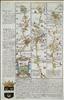
Pages 53/54 - Towcester, Daventry, Coventry, Coleshill, Lichfield. In 1720 Thomas Bowles and Emanuel Bowen published a new reduced version of John Ogilby's strip maps. Britannia Depicta came hot on the heels of the two reduced editions issued the previous year by Thomas Gardner and John Senex, but was much more innovative. Where Gardner and Senex had closely followed the strip layout and design of Ogilby, the new work further reduced the size of the volume, by including only 3 or 4 strips per page, and by printing on both sides of the page, but also added a considerable amount of additional detail by way of historical and topographical notes and heraldry. This additional information turned the work into much more than just a road book - it was virtually a guide book. This added detail was researched and provided by John Owen, who passed it to Bowen to incorporate into the layout and engraving of the pages. The work also included a set of English and Welsh county maps. Britannia Depicta became a great commercial success, and was re-issued a number of times up to 1764, with occasional amendments and additions.


Pages 59/60 - London, Brentford, Hounslow, Staines, Egham, Bagshot. In 1720 Thomas Bowles and Emanuel Bowen published a new reduced version of John Ogilby's strip maps. Britannia Depicta came hot on the heels of the two reduced editions issued the previous year by Thomas Gardner and John Senex, but was much more innovative. Where Gardner and Senex had closely followed the strip layout and design of Ogilby, the new work further reduced the size of the volume, by including only 3 or 4 strips per page, and by printing on both sides of the page, but also added a considerable amount of additional detail by way of historical and topographical notes and heraldry. This additional information turned the work into much more than just a road book - it was virtually a guide book. This added detail was researched and provided by John Owen, who passed it to Bowen to incorporate into the layout and engraving of the pages. The work also included a set of English and Welsh county maps. Britannia Depicta became a great commercial success, and was re-issued a number of times up to 1764, with occasional amendments and additions. On this example the road map is printed on one side of the page only, the verso carrying part of the description of London.


Pages 63/64 - Shaftesbury, Sherborne, Yeoveil, Axminster, Exeter, Chudleigh. In 1720 Thomas Bowles and Emanuel Bowen published a new reduced version of John Ogilby's strip maps. Britannia Depicta came hot on the heels of the two reduced editions issued the previous year by Thomas Gardner and John Senex, but was much more innovative. Where Gardner and Senex had closely followed the strip layout and design of Ogilby, the new work further reduced the size of the volume, by including only 3 or 4 strips per page, and by printing on both sides of the page, but also added a considerable amount of additional detail by way of historical and topographical notes and heraldry. This additional information turned the work into much more than just a road book - it was virtually a guide book. This added detail was researched and provided by John Owen, who passed it to Bowen to incorporate into the layout and engraving of the pages. The work also included a set of English and Welsh county maps. Britannia Depicta became a great commercial success, and was re-issued a number of times up to 1764, with occasional amendments and additions.


Pages 67/68 - Tregony, Penzanze, St. Buryon, Land's End. In 1720 Thomas Bowles and Emanuel Bowen published a new reduced version of John Ogilby's strip maps. Britannia Depicta came hot on the heels of the two reduced editions issued the previous year by Thomas Gardner and John Senex, but was much more innovative. Where Gardner and Senex had closely followed the strip layout and design of Ogilby, the new work further reduced the size of the volume, by including only 3 or 4 strips per page, and by printing on both sides of the page, but also added a considerable amount of additional detail by way of historical and topographical notes and heraldry. This additional information turned the work into much more than just a road book - it was virtually a guide book. This added detail was researched and provided by John Owen, who passed it to Bowen to incorporate into the layout and engraving of the pages. The work also included a set of English and Welsh county maps. Britannia Depicta became a great commercial success, and was re-issued a number of times up to 1764, with occasional amendments and additions. This example is from the first edition of 1720. It has a road map on one side only, the verso carrying part of the description of London.


Pages 75/76 - Woodgate, Lamberhurst, Hawkhurst Newended, Rye. In 1720 Thomas Bowles and Emanuel Bowen published a new reduced version of John Ogilby's strip maps. Britannia Depicta came hot on the heels of the two reduced editions issued the previous year by Thomas Gardner and John Senex, but was much more innovative. Where Gardner and Senex had closely followed the strip layout and design of Ogilby, the new work further reduced the size of the volume, by including only 3 or 4 strips per page, and by printing on both sides of the page, but also added a considerable amount of additional detail by way of historical and topographical notes and heraldry. This additional information turned the work into much more than just a road book - it was virtually a guide book. This added detail was researched and provided by John Owen, who passed it to Bowen to incorporate into the layout and engraving of the pages. The work also included a set of English and Welsh county maps. Britannia Depicta became a great commercial success, and was re-issued a number of times up to 1764, with occasional amendments and additions. This example has a road map on one side only, the verso carrying part of the description of London.

Pages 79/80 - Maiden Bradley, Bruton, Bridgewater, Dulverton. In 1720 Thomas Bowles and Emanuel Bowen published a new reduced version of John Ogilby's strip maps. Britannia Depicta came hot on the heels of the two reduced editions issued the previous year by Thomas Gardner and John Senex, but was much more innovative. Where Gardner and Senex had closely followed the strip layout and design of Ogilby, the new work further reduced the size of the volume, by including only 3 or 4 strips per page, and by printing on both sides of the page, but also added a considerable amount of additional detail by way of historical and topographical notes and heraldry. This additional information turned the work into much more than just a road book - it was virtually a guide book. This added detail was researched and provided by John Owen, who passed it to Bowen to incorporate into the layout and engraving of the pages. The work also included a set of English and Welsh county maps. Britannia Depicta became a great commercial success, and was re-issued a number of times up to 1764, with occasional amendments and additions.


Pages 81/82 - South Molton, Barnstaple, Torrington, Launceston, Camelford. In 1720 Thomas Bowles and Emanuel Bowen published a new reduced version of John Ogilby's strip maps. Britannia Depicta came hot on the heels of the two reduced editions issued the previous year by Thomas Gardner and John Senex, but was much more innovative. Where Gardner and Senex had closely followed the strip layout and design of Ogilby, the new work further reduced the size of the volume, by including only 3 or 4 strips per page, and by printing on both sides of the page, but also added a considerable amount of additional detail by way of historical and topographical notes and heraldry. This additional information turned the work into much more than just a road book - it was virtually a guide book. This added detail was researched and provided by John Owen, who passed it to Bowen to incorporate into the layout and engraving of the pages. The work also included a set of English and Welsh county maps. Britannia Depicta became a great commercial success, and was re-issued a number of times up to 1764, with occasional amendments and additions. This example is from the first edition of 1720.


Pages 87/88 - Stilton, Peterborough, Crowland, Spalding, Purfleet. In 1720 Thomas Bowles and Emanuel Bowen published a new reduced version of John Ogilby's strip maps. Britannia Depicta came hot on the heels of the two reduced editions issued the previous year by Thomas Gardner and John Senex, but was much more innovative. Where Gardner and Senex had closely followed the strip layout and design of Ogilby, the new work further reduced the size of the volume, by including only 3 or 4 strips per page, and by printing on both sides of the page, but also added a considerable amount of additional detail by way of historical and topographical notes and heraldry. This additional information turned the work into much more than just a road book - it was virtually a guide book. This added detail was researched and provided by John Owen, who passed it to Bowen to incorporate into the layout and engraving of the pages. The work also included a set of English and Welsh county maps. Britannia Depicta became a great commercial success, and was re-issued a number of times up to 1764, with occasional amendments and additions. This example is from the first edition of 1720.


Pages 93/94 - Garstang, Lancaster, Kendal. Perith, Carlisle. In 1720 Thomas Bowles and Emanuel Bowen published a new reduced version of John Ogilby's strip maps. Britannia Depicta came hot on the heels of the two reduced editions issued the previous year by Thomas Gardner and John Senex, but was much more innovative. Where Gardner and Senex had closely followed the strip layout and design of Ogilby, the new work further reduced the size of the volume, by including only 3 or 4 strips per page, and by printing on both sides of the page, but also added a considerable amount of additional detail by way of historical and topographical notes and heraldry. This additional information turned the work into much more than just a road book - it was virtually a guide book. This added detail was researched and provided by John Owen, who passed it to Bowen to incorporate into the layout and engraving of the pages. The work also included a set of English and Welsh county maps. Britannia Depicta became a great commercial success, and was re-issued a number of times up to 1764, with occasional amendments and additions.This example is from the first edition of 1720.


Pages 101/102 - Tempsford, St. Neots, Stilton, Peterborough. In 1720 Thomas Bowles and Emanuel Bowen published a new reduced version of John Ogilby's strip maps. Britannia Depicta came hot on the heels of the two reduced editions issued the previous year by Thomas Gardner and John Senex, but was much more innovative. Where Gardner and Senex had closely followed the strip layout and design of Ogilby, the new work further reduced the size of the volume, by including only 3 or 4 strips per page, and by printing on both sides of the page, but also added a considerable amount of additional detail by way of historical and topographical notes and heraldry. This additional information turned the work into much more than just a road book - it was virtually a guide book. This added detail was researched and provided by John Owen, who passed it to Bowen to incorporate into the layout and engraving of the pages. The work also included a set of English and Welsh county maps. Britannia Depicta became a great commercial success, and was re-issued a number of times up to 1764, with occasional amendments and additions. Modern colour.


Pages 103/104 - Market Deeping, Bourne, Sleaford, Lincoln, Brigg, Barton-upon-Humber. In 1720 Thomas Bowles and Emanuel Bowen published a new reduced version of John Ogilby's strip maps. Britannia Depicta came hot on the heels of the two reduced editions issued the previous year by Thomas Gardner and John Senex, but was much more innovative. Where Gardner and Senex had closely followed the strip layout and design of Ogilby, the new work further reduced the size of the volume, by including only 3 or 4 strips per page, and by printing on both sides of the page, but also added a considerable amount of additional detail by way of historical and topographical notes and heraldry. This additional information turned the work into much more than just a road book - it was virtually a guide book. This added detail was researched and provided by John Owen, who passed it to Bowen to incorporate into the layout and engraving of the pages. The work also included a set of English and Welsh county maps. Britannia Depicta became a great commercial success, and was re-issued a number of times up to 1764, with occasional amendments and additions.


Pages 111/112 - Tenby, Ludlow, Bishop's Castle, Montgomery. In 1720 Thomas Bowles and Emanuel Bowen published a new reduced version of John Ogilby's strip maps. Britannia Depicta came hot on the heels of the two reduced editions issued the previous year by Thomas Gardner and John Senex, but was much more innovative. Where Gardner and Senex had closely followed the strip layout and design of Ogilby, the new work further reduced the size of the volume, by including only 3 or 4 strips per page, and by printing on both sides of the page, but also added a considerable amount of additional detail by way of historical and topographical notes and heraldry. This additional information turned the work into much more than just a road book - it was virtually a guide book. This added detail was researched and provided by John Owen, who passed it to Bowen to incorporate into the layout and engraving of the pages. The work also included a set of English and Welsh county maps. Britannia Depicta became a great commercial success, and was re-issued a number of times up to 1764, with occasional amendments and additions. This example has a road map on one side only, the verso carrying a description of the Bedford Levels.


Pages 121/122 - Oakham, Melton Mowbray, Nottingham, Mansfield, Clowne, Rotherham, Barnsley. In 1720 Thomas Bowles and Emanuel Bowen published a new reduced version of John Ogilby's strip maps. Britannia Depicta came hot on the heels of the two reduced editions issued the previous year by Thomas Gardner and John Senex, but was much more innovative. Where Gardner and Senex had closely followed the strip layout and design of Ogilby, the new work further reduced the size of the volume, by including only 3 or 4 strips per page, and by printing on both sides of the page, but also added a considerable amount of additional detail by way of historical and topographical notes and heraldry. This additional information turned the work into much more than just a road book - it was virtually a guide book. This added detail was researched and provided by John Owen, who passed it to Bowen to incorporate into the layout and engraving of the pages. The work also included a set of English and Welsh county maps. Britannia Depicta became a great commercial success, and was re-issued a number of times up to 1764, with occasional amendments and additions.


Pages 123/124 - Barnsley, Halifax, Keighley, Skipton, Kettlewell, Richmond. In 1720 Thomas Bowles and Emanuel Bowen published a new reduced version of John Ogilby's strip maps. Britannia Depicta came hot on the heels of the two reduced editions issued the previous year by Thomas Gardner and John Senex, but was much more innovative. Where Gardner and Senex had closely followed the strip layout and design of Ogilby, the new work further reduced the size of the volume, by including only 3 or 4 strips per page, and by printing on both sides of the page, but also added a considerable amount of additional detail by way of historical and topographical notes and heraldry. This additional information turned the work into much more than just a road book - it was virtually a guide book. This added detail was researched and provided by John Owen, who passed it to Bowen to incorporate into the layout and engraving of the pages. The work also included a set of English and Welsh county maps. Britannia Depicta became a great commercial success, and was re-issued a number of times up to 1764, with occasional amendments and additions. Modern colour.


Pages 129/130 - Bagshot, Farnham, Alton, Alresford, Southampton; and Southampton, Romsey, Salisbury. In 1720 Thomas Bowles and Emanuel Bowen published a new reduced version of John Ogilby's strip maps. Britannia Depicta came hot on the heels of the two reduced editions issued the previous year by Thomas Gardner and John Senex, but was much more innovative. Where Gardner and Senex had closely followed the strip layout and design of Ogilby, the new work further reduced the size of the volume, by including only 3 or 4 strips per page, and by printing on both sides of the page, but also added a considerable amount of additional detail by way of historical and topographical notes and heraldry. This additional information turned the work into much more than just a road book - it was virtually a guide book. This added detail was researched and provided by John Owen, who passed it to Bowen to incorporate into the layout and engraving of the pages. The work also included a set of English and Welsh county maps. Britannia Depicta became a great commercial success, and was re-issued a number of times up to 1764, with occasional amendments and additions. This example is from the 1720 first edition of the work.


Pages135/136 Basingstoke, Stockbridge, Cranborne, Blandford, Dorchester, Weymouth. In 1720 Thomas Bowles and Emanuel Bowen published a new reduced version of John Ogilby's strip maps. Britannia Depicta came hot on the heels of the two reduced editions issued the previous year by Thomas Gardner and John Senex, but was much more innovative. Where Gardner and Senex had closely followed the strip layout and design of Ogilby, the new work further reduced the size of the volume, by including only 3 or 4 strips per page, and by printing on both sides of the page, but also added a considerable amount of additional detail by way of historical and topographical notes and heraldry. This additional information turned the work into much more than just a road book - it was virtually a guide book. This added detail was researched and provided by John Owen, who passed it to Bowen to incorporate into the layout and engraving of the pages. The work also included a set of English and Welsh county maps. Britannia Depicta became a great commercial success, and was re-issued a number of times up to 1764, with occasional amendments and additions. This example if from the first edition of 1720.


Pages 145/146 - Hereford, Leominster, Ludlow, Church Stretton, Shrewsbury. In 1720 Thomas Bowles and Emanuel Bowen published a new reduced version of John Ogilby's strip maps. Britannia Depicta came hot on the heels of the two reduced editions issued the previous year by Thomas Gardner and John Senex, but was much more innovative. Where Gardner and Senex had closely followed the strip layout and design of Ogilby, the new work further reduced the size of the volume, by including only 3 or 4 strips per page, and by printing on both sides of the page, but also added a considerable amount of additional detail by way of historical and topographical notes and heraldry. This additional information turned the work into much more than just a road book - it was virtually a guide book. This added detail was researched and provided by John Owen, who passed it to Bowen to incorporate into the layout and engraving of the pages. The work also included a set of English and Welsh county maps. Britannia Depicta became a great commercial success, and was re-issued a number of times up to 1764, with occasional amendments and additions.


Pages 149/150 - Bristol, Wells, Glastonbury, Taunton, Wellington, Exeter. In 1720 Thomas Bowles and Emanuel Bowen published a new reduced version of John Ogilby's strip maps. Britannia Depicta came hot on the heels of the two reduced editions issued the previous year by Thomas Gardner and John Senex, but was much more innovative. Where Gardner and Senex had closely followed the strip layout and design of Ogilby, the new work further reduced the size of the volume, by including only 3 or 4 strips per page, and by printing on both sides of the page, but also added a considerable amount of additional detail by way of historical and topographical notes and heraldry. This additional information turned the work into much more than just a road book - it was virtually a guide book. This added detail was researched and provided by John Owen, who passed it to Bowen to incorporate into the layout and engraving of the pages. The work also included a set of English and Welsh county maps. Britannia Depicta became a great commercial success, and was re-issued a number of times up to 1764, with occasional amendments and additions.


Pages 161/162 - Jedburgh, Berwick / Carlisle, Berwick. In 1720 Thomas Bowles and Emanuel Bowen published a new reduced version of John Ogilby's strip maps. Britannia Depicta came hot on the heels of the two reduced editions issued the previous year by Thomas Gardner and John Senex, but was much more innovative. Where Gardner and Senex had closely followed the strip layout and design of Ogilby, the new work further reduced the size of the volume, by including only 3 or 4 strips per page, and by printing on both sides of the page, but also added a considerable amount of additional detail by way of historical and topographical notes and heraldry. This additional information turned the work into much more than just a road book - it was virtually a guide book. This added detail was researched and provided by John Owen, who passed it to Bowen to incorporate into the layout and engraving of the pages. The work also included a set of English and Welsh county maps. Britannia Depicta became a great commercial success, and was re-issued a number of times up to 1764, with occasional amendments and additions. This sheet has the road map on one side only, the verso carrying a text description of Cambridge University. Modern colour.
Pages 165/166 - Llanfillyn, Tregynon, Llanbadarn, Fynydd, Builth Wells, Brecon. In 1720 Thomas Bowles and Emanuel Bowen published a new reduced version of John Ogilby's strip maps. Britannia Depicta came hot on the heels of the two reduced editions issued the previous year by Thomas Gardner and John Senex, but was much more innovative. Where Gardner and Senex had closely followed the strip layout and design of Ogilby, the new work further reduced the size of the volume, by including only 3 or 4 strips per page, and by printing on both sides of the page, but also added a considerable amount of additional detail by way of historical and topographical notes and heraldry. This additional information turned the work into much more than just a road book - it was virtually a guide book. This added detail was researched and provided by John Owen, who passed it to Bowen to incorporate into the layout and engraving of the pages. The work also included a set of English and Welsh county maps. Britannia Depicta became a great commercial success, and was re-issued a number of times up to 1764, with occasional amendments and additions.


Pages 169/170 - Dartmouth, Newton Abbot, Exeter, Tiverton, Bampton, Mnehead. In 1720 Thomas Bowles and Emanuel Bowen published a new reduced version of John Ogilby's strip maps. Britannia Depicta came hot on the heels of the two reduced editions issued the previous year by Thomas Gardner and John Senex, but was much more innovative. Where Gardner and Senex had closely followed the strip layout and design of Ogilby, the new work further reduced the size of the volume, by including only 3 or 4 strips per page, and by printing on both sides of the page, but also added a considerable amount of additional detail by way of historical and topographical notes and heraldry. This additional information turned the work into much more than just a road book - it was virtually a guide book. This added detail was researched and provided by John Owen, who passed it to Bowen to incorporate into the layout and engraving of the pages. The work also included a set of English and Welsh county maps. Britannia Depicta became a great commercial success, and was re-issued a number of times up to 1764, with occasional amendments and additions.


Pages 173/174 - Llanarth, Lyanrhystud, Talybont, Machynlleth, Llanymawddwy, Llangower, Llyn Tegid, . In 1720 Thomas Bowles and Emanuel Bowen published a new reduced version of John Ogilby's strip maps. Britannia Depicta came hot on the heels of the two reduced editions issued the previous year by Thomas Gardner and John Senex, but was much more innovative. Where Gardner and Senex had closely followed the strip layout and design of Ogilby, the new work further reduced the size of the volume, by including only 3 or 4 strips per page, and by printing on both sides of the page, but also added a considerable amount of additional detail by way of historical and topographical notes and heraldry. This additional information turned the work into much more than just a road book - it was virtually a guide book. This added detail was researched and provided by John Owen, who passed it to Bowen to incorporate into the layout and engraving of the pages. The work also included a set of English and Welsh county maps. Britannia Depicta became a great commercial success, and was re-issued a number of times up to 1764, with occasional amendments and additions. This example is from the first edition of 1720.


Pages 175/176 - Bala, Betws, Gwerfil Goch, Ruthin, Holywell . In 1720 Thomas Bowles and Emanuel Bowen published a new reduced version of John Ogilby's strip maps. Britannia Depicta came hot on the heels of the two reduced editions issued the previous year by Thomas Gardner and John Senex, but was much more innovative. Where Gardner and Senex had closely followed the strip layout and design of Ogilby, the new work further reduced the size of the volume, by including only 3 or 4 strips per page, and by printing on both sides of the page, but also added a considerable amount of additional detail by way of historical and topographical notes and heraldry. This additional information turned the work into much more than just a road book - it was virtually a guide book. This added detail was researched and provided by John Owen, who passed it to Bowen to incorporate into the layout and engraving of the pages. The work also included a set of English and Welsh county maps. Britannia Depicta became a great commercial success, and was re-issued a number of times up to 1764, with occasional amendments and additions. This example has a road map to one side only, the verso carrying a description of Exeter.


Pages 189/190 - Hereford, Worcester, Droitwich, Bromsgrove, Solihull, Coventry, Sharnford, Leicester. In 1720 Thomas Bowles and Emanuel Bowen published a new reduced version of John Ogilby's strip maps. Britannia Depicta came hot on the heels of the two reduced editions issued the previous year by Thomas Gardner and John Senex, but was much more innovative. Where Gardner and Senex had closely followed the strip layout and design of Ogilby, the new work further reduced the size of the volume, by including only 3 or 4 strips per page, and by printing on both sides of the page, but also added a considerable amount of additional detail by way of historical and topographical notes and heraldry. This additional information turned the work into much more than just a road book - it was virtually a guide book. This added detail was researched and provided by John Owen, who passed it to Bowen to incorporate into the layout and engraving of the pages. The work also included a set of English and Welsh county maps. Britannia Depicta became a great commercial success, and was re-issued a number of times up to 1764, with occasional amendments and additions.

Pages 195/196 - Ipswich, Norwich, Aylsham, Cromer. In 1720 Thomas Bowles and Emanuel Bowen published a new reduced version of John Ogilby's strip maps. Britannia Depicta came hot on the heels of the two reduced editions issued the previous year by Thomas Gardner and John Senex, but was much more innovative. Where Gardner and Senex had closely followed the strip layout and design of Ogilby, the new work further reduced the size of the volume, by including only 3 or 4 strips per page, and by printing on both sides of the page, but also added a considerable amount of additional detail by way of historical and topographical notes and heraldry. This additional information turned the work into much more than just a road book - it was virtually a guide book. This added detail was researched and provided by John Owen, who passed it to Bowen to incorporate into the layout and engraving of the pages. The work also included a set of English and Welsh county maps. Britannia Depicta became a great commercial success, and was re-issued a number of times up to 1764, with occasional amendments and additions.


Pages 201/202 - King's Lynn, Billingford, Norwich, Great Yarmouth. In 1720 Thomas Bowles and Emanuel Bowen published a new reduced version of John Ogilby's strip maps. Britannia Depicta came hot on the heels of the two reduced editions issued the previous year by Thomas Gardner and John Senex, but was much more innovative. Where Gardner and Senex had closely followed the strip layout and design of Ogilby, the new work further reduced the size of the volume, by including only 3 or 4 strips per page, and by printing on both sides of the page, but also added a considerable amount of additional detail by way of historical and topographical notes and heraldry. This additional information turned the work into much more than just a road book - it was virtually a guide book. This added detail was researched and provided by John Owen, who passed it to Bowen to incorporate into the layout and engraving of the pages. The work also included a set of English and Welsh county maps. Britannia Depicta became a great commercial success, and was re-issued a number of times up to 1764, with occasional amendments and additions.


Pages 207/208 - Nottingham, Newark, Lincoln, Market Rased, Brigsley, Grimsby. In 1720 Thomas Bowles and Emanuel Bowen published a new reduced version of John Ogilby's strip maps. Britannia Depicta came hot on the heels of the two reduced editions issued the previous year by Thomas Gardner and John Senex, but was much more innovative. Where Gardner and Senex had closely followed the strip layout and design of Ogilby, the new work further reduced the size of the volume, by including only 3 or 4 strips per page, and by printing on both sides of the page, but also added a considerable amount of additional detail by way of historical and topographical notes and heraldry. This additional information turned the work into much more than just a road book - it was virtually a guide book. This added detail was researched and provided by John Owen, who passed it to Bowen to incorporate into the layout and engraving of the pages. The work also included a set of English and Welsh county maps. Britannia Depicta became a great commercial success, and was re-issued a number of times up to 1764, with occasional amendments and additions.


Pages 209/210 - Oxford, Fyfield, Faringdon, Purton. In 1720 Thomas Bowles and Emanuel Bowen published a new reduced version of John Ogilby's strip maps. Britannia Depicta came hot on the heels of the two reduced editions issued the previous year by Thomas Gardner and John Senex, but was much more innovative. Where Gardner and Senex had closely followed the strip layout and design of Ogilby, the new work further reduced the size of the volume, by including only 3 or 4 strips per page, and by printing on both sides of the page, but also added a considerable amount of additional detail by way of historical and topographical notes and heraldry. This additional information turned the work into much more than just a road book - it was virtually a guide book. This added detail was researched and provided by John Owen, who passed it to Bowen to incorporate into the layout and engraving of the pages. The work also included a set of English and Welsh county maps. Britannia Depicta became a great commercial success, and was re-issued a number of times up to 1764, with occasional amendments and additions. This example Has a road map on one side only, the verso carrying a description of Oxford University. It is from the 1720 first edition of the work.


Pages 219/220 - Oxford, Banbury, Coventry, Ashby, Derby. In 1720 Thomas Bowles and Emanuel Bowen published a new reduced version of John Ogilby's strip maps. Britannia Depicta came hot on the heels of the two reduced editions issued the previous year by Thomas Gardner and John Senex, but was much more innovative. Where Gardner and Senex had closely followed the strip layout and design of Ogilby, the new work further reduced the size of the volume, by including only 3 or 4 strips per page, and by printing on both sides of the page, but also added a considerable amount of additional detail by way of historical and topographical notes and heraldry. This additional information turned the work into much more than just a road book - it was virtually a guide book. This added detail was researched and provided by John Owen, who passed it to Bowen to incorporate into the layout and engraving of the pages. The work also included a set of English and Welsh county maps. Britannia Depicta became a great commercial success, and was re-issued a number of times up to 1764, with occasional amendments and additions.


Pages 225/226 - Presteigne, New Radnor, Builth Wells, Llandovery, Carmarthen. In 1720 Thomas Bowles and Emanuel Bowen published a new reduced version of John Ogilby's strip maps. Britannia Depicta came hot on the heels of the two reduced editions issued the previous year by Thomas Gardner and John Senex, but was much more innovative. Where Gardner and Senex had closely followed the strip layout and design of Ogilby, the new work further reduced the size of the volume, by including only 3 or 4 strips per page, and by printing on both sides of the page, but also added a considerable amount of additional detail by way of historical and topographical notes and heraldry. This additional information turned the work into much more than just a road book - it was virtually a guide book. This added detail was researched and provided by John Owen, who passed it to Bowen to incorporate into the layout and engraving of the pages. The work also included a set of English and Welsh county maps. Britannia Depicta became a great commercial success, and was re-issued a number of times up to 1764, with occasional amendments and additions.


Pages 231/232 - Tynemouth, Newcastle, Ovington, Hexham, Haltwhistle, Carlisle. In 1720 Thomas Bowles and Emanuel Bowen published a new reduced version of John Ogilby's strip maps. Britannia Depicta came hot on the heels of the two reduced editions issued the previous year by Thomas Gardner and John Senex, but was much more innovative. Where Gardner and Senex had closely followed the strip layout and design of Ogilby, the new work further reduced the size of the volume, by including only 3 or 4 strips per page, and by printing on both sides of the page, but also added a considerable amount of additional detail by way of historical and topographical notes and heraldry. This additional information turned the work into much more than just a road book - it was virtually a guide book. This added detail was researched and provided by John Owen, who passed it to Bowen to incorporate into the layout and engraving of the pages. The work also included a set of English and Welsh county maps. Britannia Depicta became a great commercial success, and was re-issued a number of times up to 1764, with occasional amendments and additions.


Pages 241/242 - Elland, Riponden, Rochdale, Manchester, Warrington, Frodsham, Chester; and Manchester, Stockport, Disley. In 1720 Thomas Bowles and Emanuel Bowen published a new reduced version of John Ogilby's strip maps. Britannia Depicta came hot on the heels of the two reduced editions issued the previous year by Thomas Gardner and John Senex, but was much more innovative. Where Gardner and Senex had closely followed the strip layout and design of Ogilby, the new work further reduced the size of the volume, by including only 3 or 4 strips per page, and by printing on both sides of the page, but also added a considerable amount of additional detail by way of historical and topographical notes and heraldry. This additional information turned the work into much more than just a road book - it was virtually a guide book. This added detail was researched and provided by John Owen, who passed it to Bowen to incorporate into the layout and engraving of the pages. The work also included a set of English and Welsh county maps. Britannia Depicta became a great commercial success, and was re-issued a number of times up to 1764, with occasional amendments and additions.


Pages 245/246 - Carmarthen, Cardigan, Lampeter, Trefilan, Aberystwyth. In 1720 Thomas Bowles and Emanuel Bowen published a new reduced version of John Ogilby's strip maps. Britannia Depicta came hot on the heels of the two reduced editions issued the previous year by Thomas Gardner and John Senex, but was much more innovative. Where Gardner and Senex had closely followed the strip layout and design of Ogilby, the new work further reduced the size of the volume, by including only 3 or 4 strips per page, and by printing on both sides of the page, but also added a considerable amount of additional detail by way of historical and topographical notes and heraldry. This additional information turned the work into much more than just a road book - it was virtually a guide book. This added detail was researched and provided by John Owen, who passed it to Bowen to incorporate into the layout and engraving of the pages. The work also included a set of English and Welsh county maps. Britannia Depicta became a great commercial success, and was re-issued a number of times up to 1764, with occasional amendments and additions.


Pages 253/254 - Exeter, Colyford, Lyme Regis, Chideock. In 1720 Thomas Bowles and Emanuel Bowen published a new reduced version of John Ogilby's strip maps. Britannia Depicta came hot on the heels of the two reduced editions issued the previous year by Thomas Gardner and John Senex, but was much more innovative. Where Gardner and Senex had closely followed the strip layout and design of Ogilby, the new work further reduced the size of the volume, by including only 3 or 4 strips per page, and by printing on both sides of the page, but also added a considerable amount of additional detail by way of historical and topographical notes and heraldry. This additional information turned the work into much more than just a road book - it was virtually a guide book. This added detail was researched and provided by John Owen, who passed it to Bowen to incorporate into the layout and engraving of the pages. The work also included a set of English and Welsh county maps. Britannia Depicta became a great commercial success, and was re-issued a number of times up to 1764, with occasional amendments and additions. This example has a road map on one side only, the verso carrying descriptions of Dorchester and Lyme Regis.


Pages 257/258 - Leaming, Catterick, Richmond, Barnard Castle; and Ferrybridge, Pontefract, Wakefield; and Ferrybridge, Boroughbridge, Ripon. In 1720 Thomas Bowles and Emanuel Bowen published a new reduced version of John Ogilby's strip maps. Britannia Depicta came hot on the heels of the two reduced editions issued the previous year by Thomas Gardner and John Senex, but was much more innovative. Where Gardner and Senex had closely followed the strip layout and design of Ogilby, the new work further reduced the size of the volume, by including only 3 or 4 strips per page, and by printing on both sides of the page, but also added a considerable amount of additional detail by way of historical and topographical notes and heraldry. This additional information turned the work into much more than just a road book - it was virtually a guide book. This added detail was researched and provided by John Owen, who passed it to Bowen to incorporate into the layout and engraving of the pages. The work also included a set of English and Welsh county maps. Britannia Depicta became a great commercial success, and was re-issued a number of times up to 1764, with occasional amendments and additions.


Pages 267/8 - Mold to Hoywell/Chester to Holywell. In 1720 Thomas Bowles and Emanuel Bowen published a new reduced version of John Ogilby's strip maps. Britannia Depicta came hot on the heels of the two reduced editions issued the previous year by Thomas Gardner and John Senex, but was much more innovative. Where Gardner and Senex had closely followed the strip layout and design of Ogilby, the new work further reduced the size of the volume, by including only 3 or 4 strips per page, and by printing on both sides of the page, but also added a considerable amount of additional detail by way of historical and topographical notes and heraldry. This additional information turned the work into much more than just a road book - it was virtually a guide book. This added detail was researched and provided by John Owen, who passed it to Bowen to incorporate into the layout and engraving of the pages. The work also included a set of English and Welsh county maps. Britannia Depicta became a great commercial success, and was re-issued a number of times up to 1764, with occasional amendments and additions. This example has the road maps on one side only, the verso being a county map of Durham (trimmed to the left hand border and uncoloured).